
“Enormous trunks reach for the sky, lacy limbs stretch to the sun, grooved bark is sanctuary to tiny creatures in the vast cathedral of Douglas-firs that dominate the forests on this side of the Olympic Peninsula.” – National Park Service website
Sounds like my kind of place.
Staircase – a recreation area in Washington State’s Olympic National Park – is a truly magical place that has drawn my family and friends to its tranquil solitude and stunning beauty for over half a century. While often overlooked for “the sexiness of Hurricane Ridge, the romance of the [Hoh] rainforest and the teasing, visual eye-candy of the beaches of Kalaloch and LaPush” (exotichikes.com), the area’s towering trees, thundering rapids and cool, aquamarine pools have a unique appeal all their own.
In 1890, 2nd Lieutenant Joseph P. O’Neil led the first exploratory expedition across the southern stretch of the Olympic Mountains, from the North Fork Skokomish River to the East Fork Quinault River. His group of 10 soldiers and 4 civilian scientists spent the following months working to uncover the mysteries of this vast region, a project that aimed to identify both its topography and the various mineral types and plant and animal species contained within. The expedition’s scouts scrambled up slopes on all fours; descended similar slopes by sliding, deliberately or inadvertently; hacked and crawled through dense brush and windfall; waded up rivers and streams; felled trees to bridge ravines and rivers; and traversed narrow ridges of crumbling shale. Despite the difficult conditions and terrain, O’Neil declared the region ideal for national park status:
With the aid of 11 mules, O’Neil’s group ultimately cut a 5-foot swath of trail across 93 miles of wilderness, including the area today known as Staircase. The name refers to a cedar staircase built by O’Neil’s crew to ascend a rocky bluff above the North Fork Skokomish River. While the ‘Devil’s Staircase’ has long since worn away, the name – and O’Neil’s legacy – remains.
This post documents a hike taken with my parents and brother on Christmas Day in 2014. It’s somewhat of a family tradition to go on an outing in the great outdoors after enjoying breakfast and opening gifts, and on this date we were delighted with mostly filtered sunshine and sub-zero temperatures. {If you live in the Pacific Northwest, you know any outing without rain is a delight, no matter what the other conditions!} We only met a handful of other hikers on the trail, which made for a wonderfully peaceful stroll.
To reach the trailhead from the main parking lot (just beyond the Staircase Ranger Station and Campground), we crossed the North Fork of the Skokomish River on a solid, concrete bridge. Steps beyond the bridge, we passed a side trail leading left to a small structure housing the ranger station’s hydro-electric system. Approximately 0.1 mile beyond, we passed a second trail branching right, leading to what was once a towering cedar (and is now an immense windfall). The main trail – following part of Joseph O’Neil’s original mule trail – carried on straight ahead.


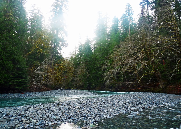
After several minutes of gentle hiking through a dense forest of Douglas fir, western hemlock, western red cedar and the occasional bigleaf maple, the trail re-joined the river. Various deer (and now human) trails fell to its banks, including a spot known as Red Rock Reef (named for the band of limestone tinted red with oxidized iron, jutting into the river’s path). While there wasn’t another soul in sight on this cold winter’s day, the ‘reef’ is a popular summer destination for hikers, swimmers and picnickers.


At 0.8 miles, the main trail forked. The right fork led to an impressive cable footbridge, built in 2013 after severe flooding washed out the previous span in the late 1990s. Perched high above the aquamarine waters and often tumultuous rapids of the Upper Skokomish, the bridge provides access to both the opposite river bank and a short loop trail heading back to the parking lot.


We opted for the left fork, continuing up the river valley on the quieter and much less-frequented Four Stream Trail. At approximately 1.0 mile from the trailhead, our party rested briefly at Beaver Flats before leaving the main trail, working our way along the river bank on a path utilized more often by local wildlife than by people. This route passes through an eerily silent, other-worldly forest of bigleaf maple, studded with viridian ferns and quite literally dripping with moss. As we admired our breathtaking surroundings, we took care to watch our step – elk herds frequent this forest, and their droppings were ubiquitious!
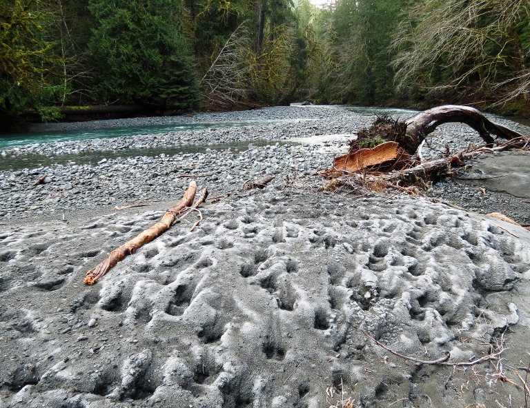
{Frozen elk tracks!}


This route ultimately led to a private campsite, picnic spot and swimming hole on the river bank. It was deserted (not a surprise, given the frigid temperatures!), so we settled in here for our lunch and hot chocolate.


After finishing lunch and packing up our belongings, we walked southwest through the bigleaf maple forest until we rejoined the main trail. At this point, we had the option of continuing on to Four Stream (roughly 0.5 miles further), or making our way back to the trailhead. We opted for the latter (Christmas dinner wasn’t going to make itself!) and returned to the parking lot with cold fingers and toes but some wonderful family memories.
Assuming we had remained on the left fork of the main trail at the junction, this hike is 4 miles round-trip (we only hiked for 3 miles, however, given our detour through the maple forest and decision to turn around before reaching Four Stream). The mostly-flat trail (elevation gain: 150 feet) is family friendly, but not dog-, bicycle- or stroller-friendly. Hiking boots or sturdy walking shoes are highly recommended. Potable water and pit toilets can be accessed in the campground or parking lot; toilets are not available at any point beyond the trailhead.
Staircase is open year-round, weather permitting*. Wilderness permits are required for overnight camping throughout Olympic National Park.
Thank you for joining me on this journey! Happy Trails! – B. June

Next week’s journey: Mürren, Switzerland
