
This week’s journey takes me back to one of the most epic adventures I’ve ever undertaken: my five day/four night solo backpacking trek Rim-to-Rim-to-Rim across the Grand Canyon.
Located in the U.S. state of Arizona, Grand Canyon National Park encompasses 277 miles (446 km) of the Colorado River and adjacent uplands. The immense Grand Canyon is a mile (1.6 km) deep, and up to 18 miles (29 km) wide. The park preserves an iconic geologic landscape and resources ranging from 1.8 billion year-old igneous and metamorphic rocks to 230 million year-old sedimentary rocks, 5 million year-old volcanic deposits, a complex tectonic and erosion history, and unconsolidated surface deposits. It hosts more than 450 species of birds, 18 species of fish, 58 species of reptiles and amphibians, and 91 mammals, including 8 species classified threatened or endangered. Vegetation in the park varies widely, and includes more than 1,700 plant species in spruce-fir forests, ponderosa pine forests, and pinyon-juniper woodlands, as well as desert scrub and riparian areas.
The Colorado River established its course through the canyon approximately 6 million years ago. Geologic processes, including erosion of tributaries and slopes, and active tectonics continue to shape the canyon today. The geologic record in the Grand Canyon is an important scientific chronicle and is largely responsible for its awe-inspiring scenery.
Numerous trails traverse the canyon, including three corridor trails that stretch from the South Rim to the North Rim, offering hikers, backpackers, and mule trains unparalleled access to some of the most spectacular vistas in the American Southwest. A hike Rim-to-Rim is 21 miles (34 kilometers), with a vertical descent – followed by a climb – of 1 mile (1.6 km). While more than 6 million travelers visit the park every year, only 1% hike to the bottom of the canyon, and fewer still attempt the arduous journey Rim-to-Rim – let alone the trek from one rim to the other and back! I was hopeful but not terribly optimistic when I entered the lottery for an October backpacking permit – corridor campsites are extremely limited, and the month I’d chosen is particularly popular – but was delighted to receive an email in early June of last year that I’d scored a permit for my first choice of campsites, from October 25 to 29!
For this blog, I’ve broken the journey into two parts – my trek South to North, and then North to South – but my complete itinerary, routes, mileage*, and elevation loss/gain were as follows:
Day 1: South Rim to Bright Angel Campground via the South Kaibab Trail – 13.8 miles, 4700′ elevation loss
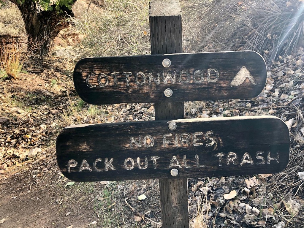
Day 2: Bright Angel Campground to Cottonwood Campground via the North Kaibab Trail (with a side trip to Ribbon Falls) – 13.0 miles, 1600′ elevation gain
Day 3: Cottonwood Campground to the North Rim to Cottonwood Campground via the North Kaibab Trail – 14.4 miles, 4700′ elevation gain/loss
Day 4: Cottonwood Campground to Indian Garden Campground via the North Kaibab and Bright Angel Trails (with a side trip to Plateau Point) – 17.0 miles, 1600′ elevation loss/1330′ elevation gain
Day 5: Indian Garden Campground to the South Rim via the Bright Angel Trail – 4.5 miles, 3060′ elevation gain
*I wander and explore quite a bit while backpacking, and this trip was no exception; as a result, my recorded mileage was in excess of the official distance between each of the locations listed above.
I initially planned to do 100% of this adventure alone – including the 8.5 hour drive each way between our home in San Diego and Grand Canyon National Park – but was delighted when my parents decided to do their anniversary trip (happy 48th, Mom and Dad!) in Arizona last year, and offered to make the long drive with me. Yes, please – road trips are always better with friends and family, especially mine! I was incredibly grateful for their laughter and company on our Sunday journey to Arizona, and for their warm hugs and well wishes as I set out on my hike early in the morning on October 25th.
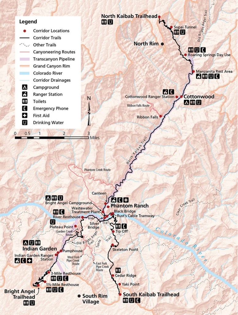
The South Kaibab trailhead (elevation: 7260′) is not accessible to private vehicles, so I caught a shuttle bus from the Grand Canyon Visitor Center shortly after 6am, and was on the trail as dawn began to illuminate the canyon at 6:30.


I hiked faster than I typically do for the first 15 minutes, and was rewarded for the speedy descent with a gorgeous sunrise at Ooh Aah Point.


I walked at a more leisurely pace for the next hour or so, admiring the breathtaking morning light on canyon walls. That ORANGE!


I stopped briefly at Cedar Ridge to shed my morning hiking layers, gawk at the view (again), and hydrate before continuing my descent.


At about 2.5 miles into the hike, I felt something buzz in my pocket. Strange – I could’ve sworn I put my phone on airplane mode as I boarded the shuttle bus that morning. I glanced at the screen, and was horrified to see a message from my dad: I’d left my migraine medication in their car. UGH. I’ve been known to develop severe headaches with sudden drops in elevation, and the approximately 5000′ I was losing that day alone were very likely to elicit one. The thought of dragging my full pack back up the 1500′ I’d already dropped made me physically ill, but my dad generously offered to hike down and bring them to me instead. Rather than have him trek that far, I scrambled back up the trail as fast as I could, and eventually met him between Cedar Ridge and Ooh Aah Point. We shared one of my mom’s homemade Rice Krispy Treats while we watched the sun’s rays spread across the canyon, and then parted ways for me to continue my hike. Thank goodness for my wonderful parents, and that I’d forgotten to put my phone on airplane mode after all!

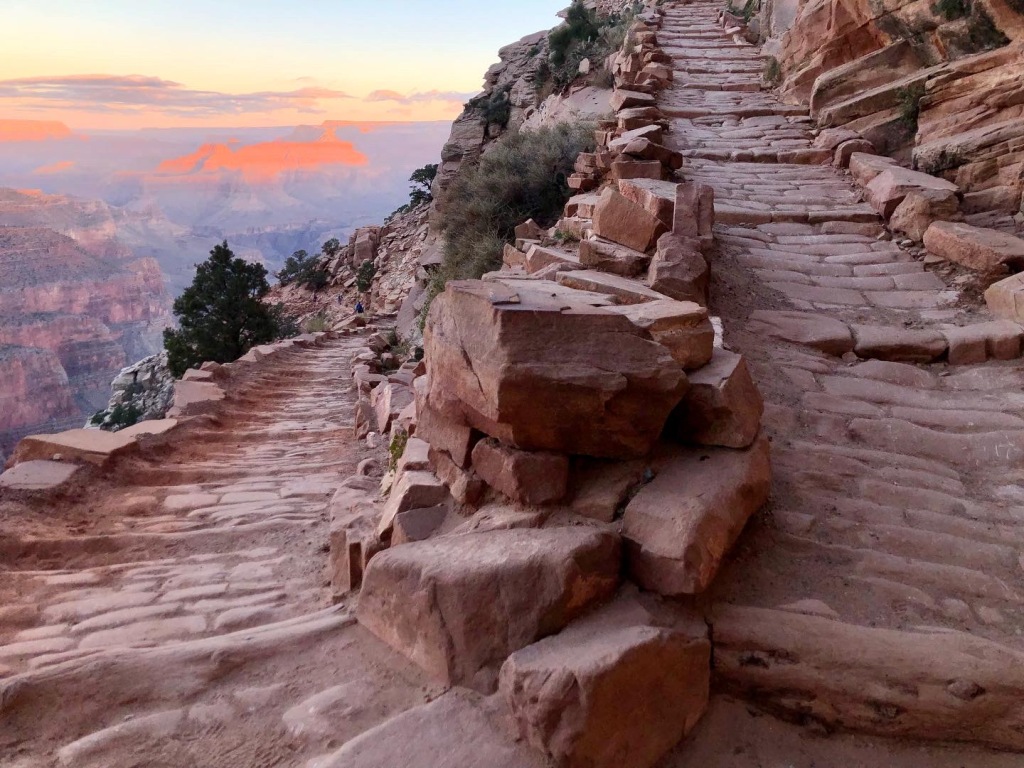
I continued down the South Kaibab Trail in near-constant awe, as new vistas appeared around every corner, each more breathtaking than the last.


I stopped briefly for a snack at Skeleton Point, and felt a shiver of excitement as the green waters of the Colorado River came into view for the first time on my journey. My destination for the day – so close but yet so far!


The trail drops precipitously here on its way to the Tonto Platform, and I was relieved to stop halfway down the switchbacks to let a mule train pass on a journey from Phantom Ranch to the South Rim.


This part of the hike is particularly dry and exposed, so I was delighted to find a shady rest area at the Tip Off to relax and eat another snack. I met some other friendly hikers here, picked up a trail name (“Cool Mama” lol), and replenished myself enough to take on the steepest and most arduous portion of the day’s hike: the final two and a half miles down to the Colorado, and to my campsite for the evening at Bright Angel. Parts of this section were blissfully shaded (thank you, high canyon walls), and I enjoyed the passage of another train of pack mules a short distance from the Tip Off.


The views of the river became ever more stunning as the trail dropped to its banks and the Black Bridge appeared beneath me.


After 8 miles and over 5000 feet of elevation loss, I arrived at the bridge with achy feet and shoulders, eager to be free of my pack and to soak my tired toes in the Colorado’s cold waters.


Bright Angel Campground – a 0.5-mile stroll from the bridge – is a gorgeous, surprisingly lush oasis at the bottom of the canyon. Its 32 campsites sit in a shady grove of cottonwood trees beside the babbling waters of Bright Angel Creek, a short walk from both the Colorado River and nearby Phantom Ranch. Each campsite has a picnic table, gear pole, and locking metal “ammo box”, designed to protect food and toiletries from the canyon’s notoriously voracious squirrels and ravens. I arrived a few minutes before noon and had the entire campground of sites (minus the group ones) to choose from, ultimately pitching my tent in site 2 before settling in for lunch and an hour of reading.


After a short rest, I wandered back toward the boat beach located on the banks of the Colorado River. Six or seven rafts had been moored at the beach when I’d passed over the bridge that morning, and I watched them depart within minutes of my arrival that afternoon. The Park Service strongly discourages swimming in the river (the current was noticeably quite strong), but there is a calm, sandy stretch perfect for wading that I took advantage of most of the afternoon. I spent the next two hours watching other hikers come and go, chatting about our respective plans for the next few days, and resting my feet in the chilly river waters. I felt on top of the world, despite being at the bottom of the Grand Canyon!


I headed back to my campsite around 3:30, visited the mule corral and canteen at nearby Phantom Ranch, and read more of my book along the shady banks of Bright Angel Creek. I also greeted a few of the campground’s permanent residents – a small group of mule deer – as they wandered through my site at dusk.


The sun in late October goes down at about 5:45pm, and it was pitch dark within the walls of the canyon by 7. Weather forecasts had predicted (with increasing certainty) a storm to come through the area that evening, so I double checked the stability of my tent’s stakes and rainfly before crawling into my sleeping bag and hoping for the best.

I was awoken shortly after 11pm by a bright flash overhead, followed swiftly by a sharp crack that reverberated for several seconds between the walls of the canyon. Rain pelted heavily against the thin fabric that separated my tent from the elements, and gust after gust of wind tugged at the stakes I had so thoroughly and carefully driven into the rocky soil, threatening to rip them out and send my rainfly into the dark oblivion.
The storm had arrived.
I snuggled down in my sleeping bag and closed my eyes again, hopeful that I could still get some sleep despite the turbulent weather outside. I drifted in and out of slumber for the next couple of hours, noting in the back of my drowsy mind that the thunder and lightning stopped around 1am. The rain and wind continued steadily, however, and in an attempt to reposition myself comfortably in my sleeping bag, I touched the bottom of my tent … and sat bolt upright. It felt like I had placed my hand on a waterbed. I moved my hands around frantically to different spots on the base, and they all felt the same. Cold. Boggy. Definitely *not* the firm surface I had chosen to erect my camp upon hours earlier. It was 2:30am, still pouring, and my tent was [bleeping] floating.
By some miracle, everything inside my tent – sleeping pad and bag, clothing, trail runners, etc. – was still completely dry. I hunkered down in my sleeping bag and tried to go back to sleep, but dozed only fitfully until 5:30. I had a breakfast reservation at the Phantom Ranch canteen at 6:30, and the promise of a hot cup of tea and a warm, freshly made breakfast was enough to lift my spirits and drag me out into the drippy morning, despite the rubbish night of sleep I’d had. I walked the short distance to Phantom Ranch in a light sprinkle, and was disappointed to learn that – because of COVID precautions – the dining hall was closed, and all of the meals were boxed for take away. I found myself a seat at a wet picnic table, struggled to get down my stone cold serving of pancakes and scrambled eggs, and then headed back to my campsite. In my haste, I forgot to make myself a cup of tea. I wandered beside the corral on my way back to Bright Angel, and passed a group of mules saddled up for their journey to the South Rim. They looked damp, weary, and over it. I could relate.


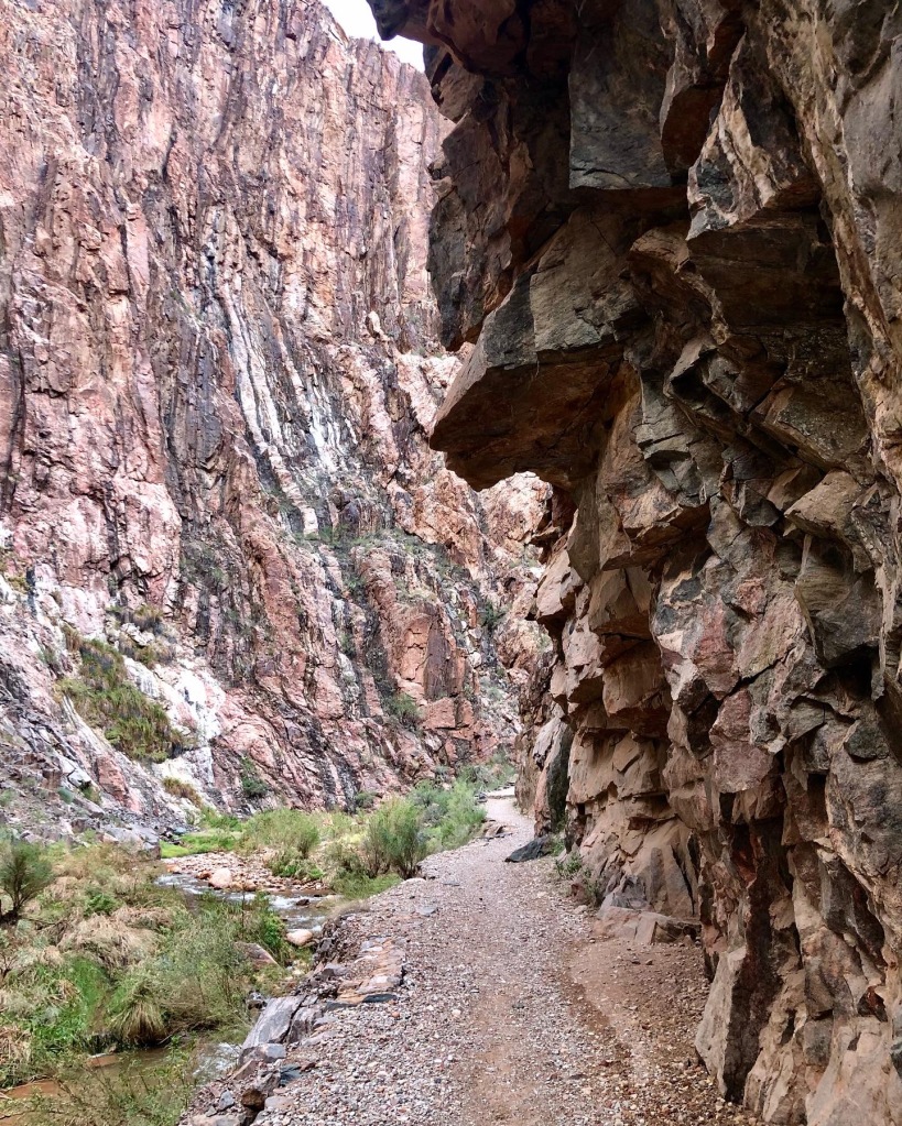
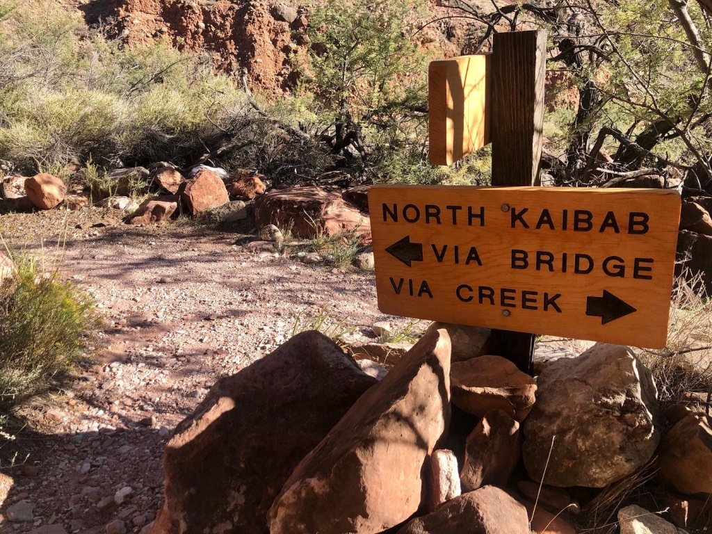
The light sprinkle turned to rain as I got back to my campsite, and I decided it was time to pack up and move on. I broke down my tent – which was indeed floating in a large puddle – packed it away as neatly as I could, and started hiking again at 7:15am. I was on my way to Cottonwood Campground, 7 miles up Bright Angel Canyon via the North Kaibab Trail. I passed back through the Phantom Ranch area before entering what is widely considered one of the Grand Canyon’s most notorious and dangerous hiking zones: “the Box”. Although not technically difficult, the Box – a relatively short and narrow stretch of canyon comprised of towering black cliff walls – heats up like an oven from late morning to early afternoon, with temperatures soaring in the summer months to 130 to 150 degrees. The Box has claimed the lives of numerous hikers over the years, and the NPS strongly recommends avoiding passage through this area from 10am to 4pm, May to September. Luckily for me, the rain had let up and the temperatures were cool – likely in the upper 50s or low 60s – when I hiked through the Box at 8am.


Bright Angel Canyon continues for several miles beyond the Box, and the trail passed over multiple bridges before finally opening into a wider valley. I took a couple of breaks to shed layers along the way, and made it to the cut-off trail to Ribbon Falls around 10:30. I knew I wanted to visit the falls – but not with my full pack – so I continued on with the intention to return later in the day.


I arrived at Cottonwood Campground – my base for the next two nights – a little after 11am. With only 12 sites, Cottonwood is smaller and considerably more rustic than the other corridor campgrounds, but was a quiet and beautiful spot from which to explore the inner canyon. I selected site number 10, and quickly set out my sopping tent, footprint and rainfly in the late morning sun. All were dry within 45 minutes, and I enjoyed a leisurely lunch while waiting.


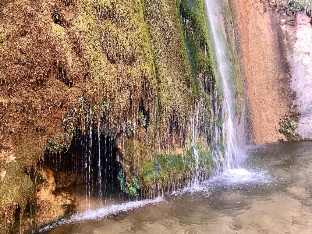
I set off for Ribbon Falls around 1:30 with my daypack (always carry the 10 essentials!), extra drinking water and one trekking pole in hand. I retraced my steps along the North Kaibab trail and made my way back to the cut-off without difficulty. I knew from previous research that the bridge over Bright Angel Creek en route to the falls had recently been removed, but had seen other hikers in the vicinity earlier that day, so was confident it was still accessible. Unfortunately, the creek was flowing strongly after the previous night’s rain, and the only way across it was to wade. I contemplated doing so barefoot for a few minutes, but it was too rocky and too deep to do so safely, so I plunged in fully clothed and hoped for the best. I emerged with soaking wet trail runners, socks, and leggings a few moments later, but was across the creek without mishap and ready to find my way to the falls. This requires a little bushwhacking and a lot of route-finding – something I am not at all fond of doing in rattlesnake and scorpion country – but I made it to the falls unscathed, and happily quite alone. I scrambled my way up to the upper section first, where you can stand in a cavern behind the torrent of water cascading over the cliffs above, and spent a few blissful minutes washing my face and hair. I then spent some quiet moments in the alcove at the base of the falls, soaking up the beautiful scenery and cool spray of water. Not everyone doing a Rim-to-Rim hike has time to make the detour to Ribbon Falls, and I felt incredibly fortunate to have experienced the magic of this private canyon oasis.


After poking and prodding at every. single. bush. between the falls and North Kaibab Trail (to ensure they were snake-free, of course), I made my way back to Cottonwood and spent the rest of the evening reading in my tent. No more rain was forecasted for the rest of my trip, so I drifted off peacefully with the knowledge I wouldn’t wake up in a sump, and excited for the start of my hike up to the North Rim.
I rose early the next morning – you tend to when you drift off at 7:30pm – and left my campsite as twilight began to illuminate the canyon walls around me.


I’d left my full pack in camp – opting to hike this section with only my daypack – and reached Manzanita Rest Area at quarter to seven. I stopped briefly there to enjoy the autumnal colors on full display beside Bright Angel Creek.


The trail climbs steadily from Manzanita but isn’t particularly steep (yet), and after a full night’s sleep I had lots of energy to spare. I passed the cut-off trail to Roaring Springs – the source of Bright Angel Creek, and of all drinking water within Grand Canyon National Park – within less than an hour of departing the campground.


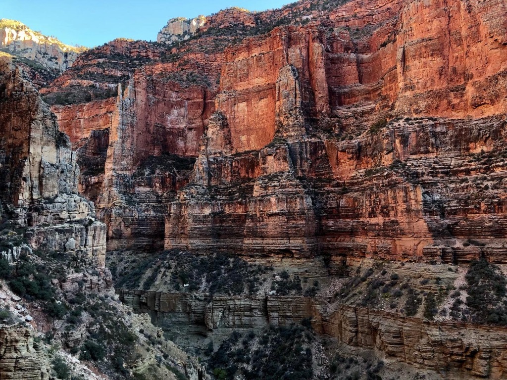
I was stopped in my tracks, however, by the sight of a large expanse of limestone running parallel to the trail. The cliffs here – collectively known as the Red Wall due to the rusty hue of iron oxide settled on the surface – were absolutely breathtaking in their scope and beauty, appearing to almost glow in the early morning light. I encountered many, many, many jaw-dropping vistas on this trip, but the Red Wall was truly something special.


After taking a gazillion photos here, I continued along the North Kaibab Trail toward the rim. The next major waypoint on the trail was Red Wall Bridge, followed by a series of steep switchbacks en route to Supai Tunnel, a 20-foot-long limestone shaft emerging into a rest area furnished with composting toilets and a water station (turned off by late October). I stopped here briefly for a snack before continuing my climb.


The sun was so bright – and its glare so harsh – that I stopped taking photos for the next hour or so, which resulted in me arriving at Coconino Overlook, and eventually the North Kaibab trailhead, about an hour earlier than expected, at roughly 10am.


I made it to the North Rim! I had arranged to meet my parents for a picnic here between 11 and 1, so I spent an hour stretching my legs and exploring the area while I waited. The storm that had bombarded me with rain and wind at Bright Angel Campground had dumped snow on the North Rim (elevation: 8297′), and there were still patches on the ground two days later. I was delighted to see my parents arrive shortly after 11, and we enjoyed a delicious lunch while I shared the news of my first two days on the trail. I also handed off some of the gear I had been hauling around but didn’t need (i.e. microspikes, freeze dried meals, stove fuel, etc.) as well as the garbage I had accumulated thus far. Unsure how long it would take me to get back to Cottonwood, I set off on the trail again at 12:45pm, with promises to see them again in two days, when I made it back to the South Rim!

The remainder of my journey – from the North Rim to the South – will pick up in our next post, featuring unseen photos of the North Kaibab Trail and Phantom Ranch, as well as new territory on the Bright Angel Trail.
Thank you for joining me on the first leg of my Grand Canyon adventure! – B. June
Next post: Backpacking the Grand Canyon Rim-to-Rim-to-Rim: Part 2

One thought on “Backpacking the Grand Canyon Rim-to-Rim-to-Rim: Part 1”